Chipata District (Chipata District)
Chipata City Centre is located about 600 km from Lusaka, the capital city of Zambia, on the Great East Road while it is only 110 km from Lilongwe, the capital city of Malawi. Thus, Chipata accesses its imports mainly from Nacala and Dar es Salaam ports in Mozambique and Tanzania respectively, all routes passing through Malawi to Mwami Border. The District has a firm foundation of being a trade centre dating back to the colonial era of the current Zambia, when it was called Fort Jameson and was the capital of North-Eastern Rhodesia up to 1911. This cornerstone has left the town as the hub of Eastern Province, by maintaining its position as a Provincial Headquarters. Chipata was declared a city on 24 February 2017 (no-longer a town).
Chipata District has two constituencies, namely Chipata Central and Luangeni.
Map - Chipata District (Chipata District)
Map
Country - Zambia
 |
 |
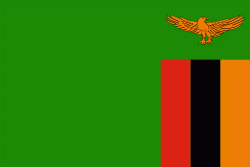
| Flag of Zambia | |
The region was affected by the Bantu expansion of the 13th century. Following the arrival of European explorers in the 18th century, the British colonised the region into the British protectorates of Barotseland-North-Western Rhodesia and North-Eastern Rhodesia comprising 73 tribes, towards the end of the 19th century. These were merged in 1911 to form Northern Rhodesia. For most of the colonial period, Zambia was governed by an administration appointed from London with the advice of the British South Africa Company. On 24 October 1964, Zambia became independent of the United Kingdom and prime minister Kenneth Kaunda became the inaugural president. From 1972 to 1991 Zambia was a one-party state with the United National Independence Party as the sole legal political party under the motto "One Zambia, One Nation" coined by Kaunda. Kaunda was succeeded by Frederick Chiluba of the social-democratic Movement for Multi-Party Democracy in 1991, beginning a period of government decentralisation.
Currency / Language
| ISO | Currency | Symbol | Significant figures |
|---|---|---|---|
| ZMW | Zambian kwacha | ZK | 2 |
| ISO | Language |
|---|---|
| NY | Chichewa language |
| EN | English language |


